Post dirtjam bugfix
Parallelised Worlds » Devlog
Now that the dirtjam is over, I'm planning to slowly improve this project. To begin with there are two issues I noticed while producing final renders for the dirtjam that are fixed in this update. As the dirtjam is so recent I'm leaving the older version of the files here as a reference as well as the new updates.
Updates:
- Layering
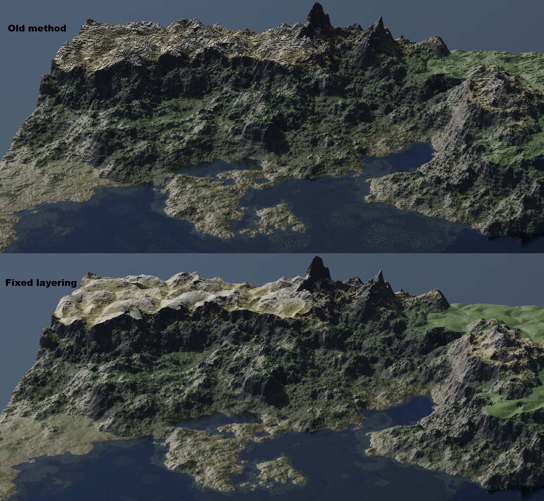
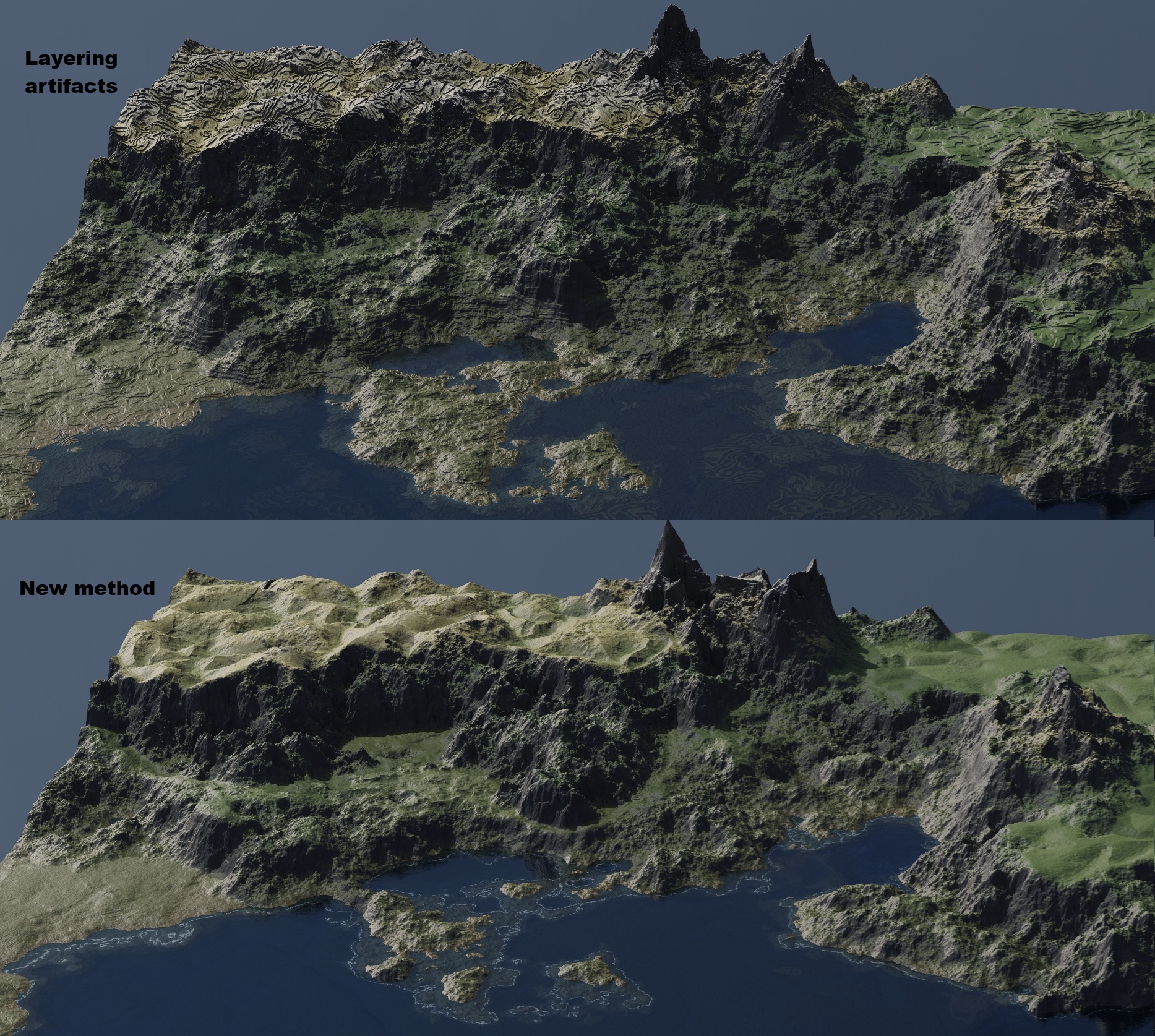
- Layering intended to create sedimentary layers via a step function is causing defects at high zoom levels on flatter areas. For now I have removed this effect, but in future I plan to bring it back for more selected areas only.
- Better blending of continental shelves.
- Boundaries between plates are much too sharp, creating solid boundaries resembling canyons or cliffs at each boundary instead of only rarely. Using the smoothstep function for base height should allow contributions of each plate more smoothly approach 0.
- Tiling
- Included an option to split the image when generating in order to allow for larger images while staying under memory limits. Most important when using dendry noise and when running on gpu. Ideally each tile should be on the order of a few seconds while using memory efficiently.
The pictures included demonstrate the previous version, removing the layerlines, and blending plates. This is an example with low contributions from dendry and voronoi mountains to better illustrate the changes (visualised in Blender, the tool still only outputs the heightmap).
Future goals:
- GUI/ease of use
- Currently it is necessary to create a python environment and run the code directly. Ideally I will include an executable version of the script with a more interactive interface.
- Non-square sampling
- The algorithm does not assume regularly spaced points, only that the coordinates can be arranged in a rectangle to construct arrays and could therefore be used for more focused sampling. However this depends on having a way to untransform and display such samples.
- Rivermaps
- The generator includes river courses as a distinct layer during calculation but only returns the height that results from them. It should be possible to separately output an image of which pixels are in vs out of rivers in order to properly texture the results.
- Caves, underground rivers
- Generation of likely cave locations should be possible by comparing the map of where there should be rivers to the resulting heightmap in order to find areas where a river 'disappears' underground. Base on this, cave textures may be generated separately.
- Lakes
- Theoretical goal, may not be possible while keeping the algorithm simulation-free.
Files
Map_Generator-main (current version).zip 5.3 MB
Aug 04, 2025
Get Parallelised Worlds
Parallelised Worlds
Fully vectorised terrain and world generation
| Status | In development |
| Category | Tool |
| Author | Edward_McT |
| Tags | Generator, Procedural Generation, Tabletop role-playing game |
More posts
- Notebook and interactive mode85 days ago
Leave a comment
Log in with itch.io to leave a comment.